On December 4, 2025, the award ceremony of the traditional Earth Observation Competition organized by Azercosmos was held. This year, the competition took place under the theme “Map of the Future” and was dedicated to the 5th anniversary of the victory in the Patriotic War.
The competition has made a significant contribution to the growing interest in satellite imagery and Geographic Information Systems (GIS) in our country in recent years. A total of 293 applications were submitted for the 2025 competition. Out of them, 74 projects were presented, and only 50 reached the final stage. The projects covered various fields, including artificial intelligence, digital solutions, the environment, cartography, and other areas.
Fuad Aslanov, Vice-Chairman of Azercosmos and Chairman of the Jury, highlighted the role of the competition in the development of space education and geoinformation technologies in our country during his speech.
An interactive quiz was also held as part of the event. Participants tested their knowledge in satellite imagery, GIS technologies, and remote sensing topics. The top five participants were awarded a one-year license for the “Esri ArcGIS Pro” platform.
Members of the jury, independent expert in GIS, PhD, Professor Rauf Amanov, and PhD Rustam Rustamov, delivered speeches on the scientific, technical, and practical value of the presented works.
One of the innovations of this year’s competition was the presentation of additional awards in five different nominations. The winners are as follows:
· Best Environmental Impact Assessment: Mehrin Azizli
· Best Digital Solution: Maleyka Pashayeva
· Best Artificial Intelligence Solution: Ertughrul Gayıbov
· Best Precision Agriculture Project: Nahid Mammadov
· Best Map Design: Fidan Valehova
Each winner received a 500 AZN cash prize and a one-year “ArcGIS Pro” license.
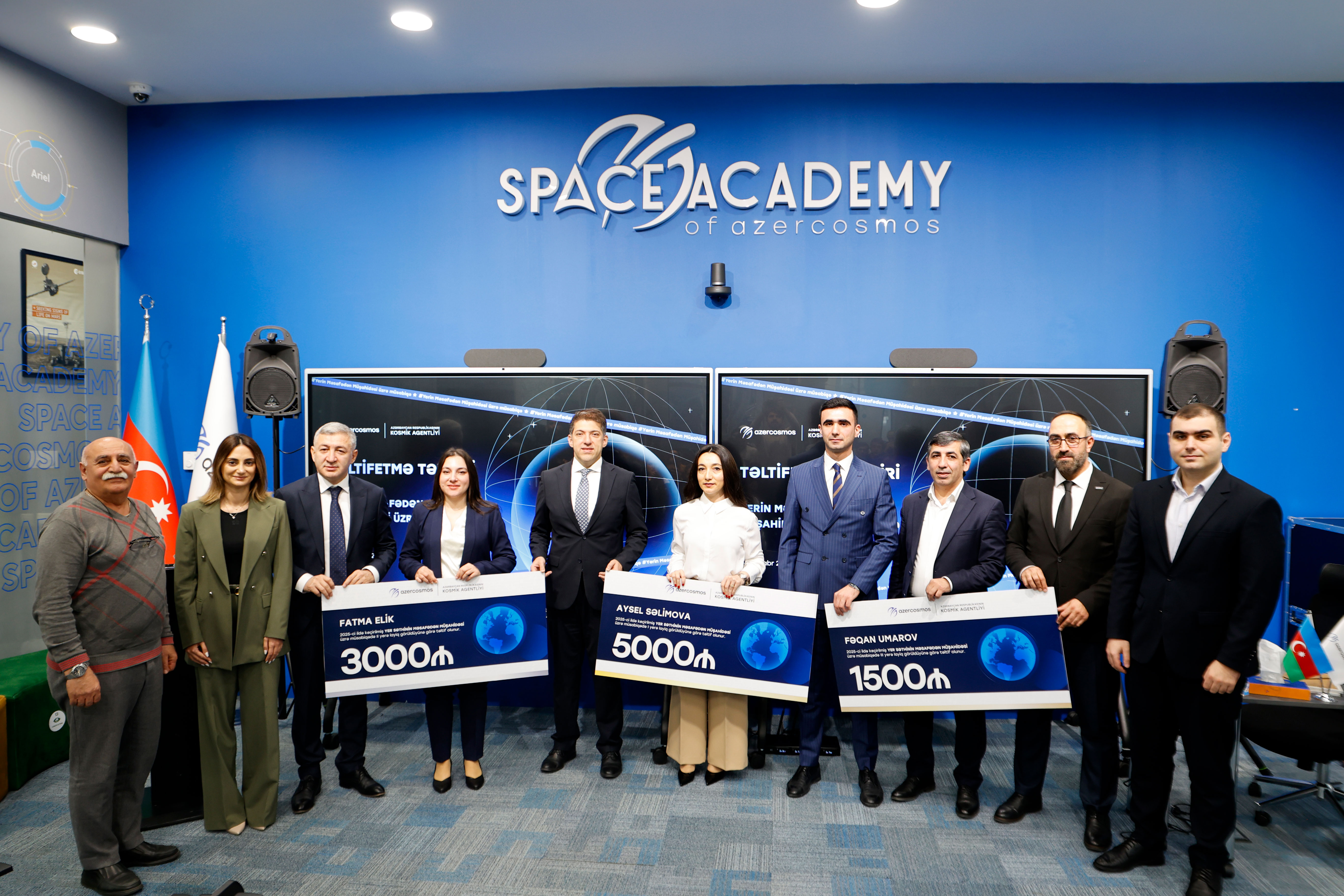
The most exciting moment of the event was the announcement of the winners for the top three places:
· 3rd place: Fagan Umarov, “Soil Surface Observation System” project
· 2nd place: Fatma Elik (Turkey), “HydroAlert Azerbaijan: AI-Powered Flood Monitoring and Forecasting System”
· 1st place: Aysel Salimova, “Prediction of Organic Carbon in Soil in Agdam Region Using GIS and Remote Sensing Methods”
The winners were awarded diplomas and special prizes.
The fact that a citizen from Türkiye was among the winners shows that the competition is recognized not only within the country but also internationally. This demonstrates that Azercosmos’ initiative has sparked regional interest and confirmed the expansion of scientific and technical cooperation in satellite data.
Azercosmos thanks the participants of the competition, wishes them success in their future projects, and assures that initiatives like this will continue to contribute to the development of geoinformation technologies in the country.
Our team is always here to support you and answer any questions you might have.